
Herry, Centre-Val de Loire 18140
LATEST
Land
NZD $8,581,737
EUR €4,297,000
Published on: 11 Oct 2026
Last updated on: 13 Oct 2026
Property ID: 310120490656
Translate to English
Herry, Centre-Val de Loire 18140
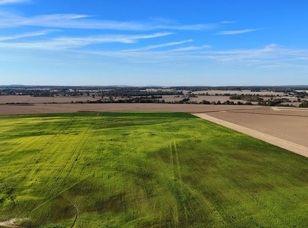
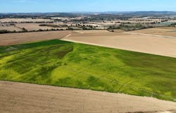
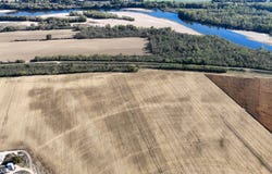
Cher (18) | Property for investors Terres & Domaines offers a contiguous landholding of 196 ha 48 a 16 ca, comprising agricultural land, meadows and woodland. This property combines existing agricultural rental income, three wells that can irrigate the land, and potential to enhance the value of the subsoil, subject to technical, land-related and regulatory feasibility. The sale does not include any buildings or equipment. The sellers three wells are included in the property being sold, but may be separated from the sale. An occupied agricultural holding According to the available parcel information, the property comprises approximately: - 173.81 ha of agricultural land - 3.63 ha of meadows - 19.05 ha of woodland and coppice. Approximately 177.25 ha are let, including 159.86 ha under long-term transferable rural leases, according to the leases and rental information provided. Another part is subject to a verbal lease. The woodland and coppice are declared to be unoccupied. Annual rent is approximately 28,000, before the owners expenses and taxes. The land is being sold subject to the existing tenancies. The purchase is therefore aimed at an investor wishing to build or expand a land portfolio, while respecting the leases and the rights of the current tenants. Hunting is declared to be free of any lease, subject to applicable restrictions, particularly on parcels within the nature reserve. Three irrigation wells Three wells belonging to the seller, which, according to the information provided, can irrigate approximately 175 hectares. Other irrigation equipment is not included in the sale. The owner states that the wells are free of water rights, subject to verification of the relevant title documents and permits. Water abstraction remains subject to regulations and any administrative restrictions, particularly during periods of drought. Sand extraction potential identified in planning documents Part of the property lies within a protected area due to the richness of its soil and subsoil, as designated by the Berry Loire Vauvise intermunicipal local urban plan (PLUi). According to the available parcel information, the area concerned is estimated at approximately 34 hectares. In these areas, the PLUi regulations provide for construction and installations necessary to develop these resources, subject to other applicable provisions and permits. According to the owner, the deposits theoretical potential is approximately 4 million tonnes of sand. This figure is indicative and does not constitute a certified exploitable reserve. It must be confirmed by geological investigations and assessed in light of the area being sold, environmental constraints and the required permits. According to the owner, a quarry operator has submitted an application for authorisation to operate the sand quarry. This information is being confirmed with the parties concerned. It does not establish that an authorisation will be granted, nor its scope or the timetable for any potential operations. The availability of let land within this area is not guaranteed. The land can be released only by agreement with the tenants concerned or, if the legal conditions are met, through a procedure to terminate the leases due to a change from agricultural use, in accordance with applicable planning provisions. Any required permits, time limits and tenants rights to compensation must be respected. The designation of this area in the PLUi does not constitute authorisation to extract sand or automatically release the let land. Risks and regulatory environment The propertys location in the Loire Valley entails several points requiring careful consideration. Flooding and rising groundwater. The Butteaux area is affected by Loire floods and by a shallow alluvial water table. The requirements of the Loire Val de La Charité Flood Risk Prevention Plan (PPRI) must be examined for each parcel. The vulnerability of groundwater to pollution must also be taken into account. Type II ZNIE
Property Details
Basic Info
Basic Info
Property Type
Land
Land Size
1,964,816.00 m2
Address
Herry, Centre-Val de Loire 18140
Contact Agent
Contact Agent
Email enquiry to TERRES & DOMAINES
Yann Gaudry
What's your enquiry about?
By clicking "Submit", you accept our Privacy Policy and acknowledge that as the agent for this property is located overseas, your information may not be handled in accordance with the privacy laws applicable to this website.
Property ID: 310120490656
Original Property ID: GRCCI-Ar6i6wsw170z6qzu* THIS SERVICE MAY CONTAIN TRANSLATIONS POWERED BY GOOGLE. GOOGLE DISCLAIMS ALL WARRANTIES RELATED TO THE TRANSLATIONS, EXPRESS OR IMPLIED, INCLUDING ANY WARRANTIES OF ACCURACY, RELIABILITY, AND ANY IMPLIED WARRANTIES OF MERCHANTABILITY, FITNESS FOR A PARTICULAR PURPOSE AND NONINFRINGEMENT.
 4
4 1
1